
Written By: Zach Champ
Edited By: Chris H.

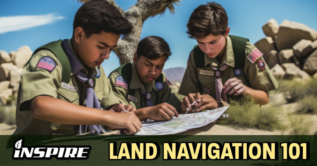
WHAT IS LAND NAVIGATION?
Whether you are a seasoned outdoor enthusiast or a beginner looking to explore the wilderness, understanding how to navigate using a map and compass is a fundamental skill that can be the difference between life and death.
By the end of this, you’ll understand how to tell what kind of map you’re looking at, how to read it, figure out where you are on it, and make plans to travel all across the globe with ease, efficiency, and foresight.
This is a guide to help you master the art of navigation and maneuver through unfamiliar terrain with confidence!

Ahead there’s gonna be some terms and vocab about maps which may be new to you, but keep in mind, maps are just information. You can use them to figure out where you are in the world, what’s around you in the world, and how to get to different places in the world. Once you practice some of these basic skills, like finding which way you’re facing, and which way you should face to adjust your course, it will become pretty intuitive.
Anyone reading this has been doing land navigation since they could walk, all of us have oriented ourselves, set a course, and navigated it. This guide is just going to help you do that on a higher level.
Land navigation is the process of determining your current location and navigating to a desired destination using a map and compass. This art and science involves understanding how to read a map, orienting yourself with your surroundings, and maneuver through terrain using various navigation techniques.
HOW TO READ A MAP
The first step in land navigation is learning how to understand and read a map… A map is a two-dimensional representation of a three-dimensional landscape.
There are several types of maps, you’re probably most used to using basic road maps in your GPS, but other maps can indicate everything from terrain features to weather to pretty much anything someone would need to find and navigate.


Usually, you’re going to be holding either a topographical map, which shows you the shape and features of terrain, and a so-called flat map which just lacks those more detailed features about the shape of the earth.
Most people are probably used to navigating with Google Maps or something similar, which by default display a flat map. Navigating over any kind of map uses the same principles, but we’ll touch on the advantages that having information about terrain can give you later in the piece.
Maps are generally divided into two parts: marginal information and guides, and the map itself.
- Marginal Information and Guides: This section of the map provides key information about the map, such as the title, scale, contour interval, and legend. The map legend contains symbols that represent different features on the map, such as roads, water sources, and vegetation.

- Map Scale: The map scale tells you how much area is represented on the map. For example, a 1:24,000 scale map means that one inch on the map equals 24,000 inches (or 2,000 feet) on the ground.

- Declination: Declination is the difference between true north and magnetic north. This can vary depending on your location, and is important to know when using a compass.

-
True North: True north is the direction to the North Pole. It is the reference for all maps and compasses.
- Grid North: Grid north is the direction of the vertical grid lines on the map. It is used to measure distance and direction on the map.

- Magnetic North: Magnetic north is the direction that a compass needle points. It is affected by magnetic fields and can vary depending on your location. Because of this, when you check your map it can be important to make sure your magnetic north is the same as it was the last time you maneuvered.

- G-M Angle: The difference between true north and magnetic north is the G-M Angle, this is important for the simple reason that a magnetic compass cannot magically detect grid north, however grid north is often how maps are oriented, so the north on your compass (thus all the other directions) are an exact angle deflected from the grid compass on the map. Declination is important to notice.
Military and industrial maps sometimes have standardized colors to identify key terrain and characteristics of an area.

Common examples include:
- Black- building, Railroads, and roads, Property boundaries
- Red/Brown- major highways and roads
- Blue- Water such as Rivers, Lakes, Streams and Oceans
- Green- vegetation such as woods, orchards, forests, state parks, vineyards, etc

Map Reading Tools: Two essential tools for map reading are a compass and a protractor. A compass is used to determine direction, while a protractor is used to measure angles on the map.
Projecting and Reading Four, Six, and Right Digital Grid Coordinates:
Determining your precise location on a map is very easy when using a protractor and a little bit of trigonometry!
You will need two key pieces of information from your map:
- The Grid Zone Designation which is a 100,000 square meter key from the grid reference box
- The Grid Coordinates of your location.
Four digit coordinates provide accuracy within a 1,000 square meter area.

Six digit coordinates provide accuracy within a 100 square meter area

Eight digit coordinates provide accuracy within a 10 square meter area

Using a Map Protractor: A map protractor is useful for determining distances on angles. On the map key you have a distance scale, but of course this is horizontal and in the corner. The grid can give you distance, but only at 90-degree angles on the map.
With a protractor you can adjust it to the distance you want to measure, and then use it to draw an arc, so if you need to say, know which point on a map is under 5 miles away, you can draw a 5 mile arc from your location and simply observe which of the points is inside or outside the arc.
HOW TO NAVIGATE AND MANEUVER:
Azimuths: An azimuth is a horizontal angle measured in degrees or mils. It is used to determine the direction of travel from one point to another. The phrase, ‘shoot an azimuth’ is to draw a line along a heading you want to travel.

A back azimuth is the opposite direction of an azimuth. For example, if the azimuth is 180 degrees, the back azimuth is 0 degrees.
Magnetic Azimuth: A magnetic azimuth is the angle between magnetic north and your destination. A magnetic azimuth is the direction of travel as determined by a magnetic compass. Magnetic azimuths are used when navigating with a compass. It is important to adjust for declination when using a compass to determine a magnetic azimuth.

Degrees and Mils: Degrees and mils are units of measurement used to describe azimuths. One degree is equal to 1/360th of a circle, while one mil is equal to 1/6400th of a circle. Degrees are the most common unit of measurement for azimuths, but mils are also used in military applications.
To determine a magnetic azimuth using a compass, you need to know your current location, your desired destination, and the declination for your location.


The compass to cheek/sighting method is used to determine a magnetic azimuth. It involves sighting along the edge of the compass and aligning the sighting line with the desired target.
Converting Azimuths and Determining the Grid/Magnetic Angle:
Converting Azimuths and Determining the Grid/Magnetic Angle: To convert an azimuth from grid to magnetic or vice versa, you need to know the grid-magnetic angle for your location.
Declination is the difference between true north and magnetic north. Declination varies depending on location and can be found on a map.
To adjust for the grid-magnetic angle, navigators must add or subtract the angle from their magnetic azimuth.
Locating Unknown Points: There are several techniques for locating unknown points on a map, such as intersection, resection, and polar plot.

In land navigation, an intersection is used to determine the location of an unknown point. An intersection is the point at which two or more lines intersect.
Likewise, resection is the process of determining your location by using two or more known points. Resection is used when you are lost or unsure of your location.

A polar plot is the best way to navigate to an unmarked location, it’s simple and intuitive as well. All making a polar plot is, is knowing the azimuth you have to travel on, and measuring how far along that azimuth your point is. It’s similar to intersection in this way, but it’s a bit more accurate, and as you get better at it, it can be done very fast with a protractor.
Once you have your azimuth, you can use it to navigate in the direction you want to go. However, it's important to remember that the earth's surface is not always flat, and obstacles can get in the way of a direct path. This is where terrain features come into play.
TYPES OF TERRAIN:
Terrain is the natural features of the land's surface that make up the topography.
Land Navigators must learn to identify various types of terrain to effectively navigate through it. Terrain can be classified into two categories: major terrain features and minor terrain features.
Understanding the different types of terrain is essential for navigating through unfamiliar landscapes.
Major terrain features, such as hills, valleys, and ridges, can help you orient yourself and navigate in the right direction.
Minor terrain features, such as draws and spurs, can help you navigate through more complex terrain.
Major Terrain Features:
- Hill: A raised area of land that is elevated above the surrounding area.

- Saddle: A dip or low point between two hills, with higher ground on either side.

- Valley: A low area between hills or mountains, often with a stream or river flowing through it.

- Ridge: A long, narrow elevation of land with steep sides, often forming the backbone of a mountain range.

- Depression: A low area of land that is depressed below the surrounding area.
Minor Terrain Features:

- Draw: A terrain feature that is a linear depression in the ground.

- Spur: A short, continuous sloping line of higher ground, jutting out from the side of a ridge.

- Cliff: A steep, high rock face, often along the side of a mountain or overlooking a body of water.

- Cut: A man-made linear excavation in the terrain.
- Fill: A man-made linear deposit of material on the terrain.
Navigating through different types of terrain can be challenging.
For example, crossing a river or climbing a steep hill can slow you down and make it harder to maintain a consistent pace. It's important to take these obstacles into account when planning your route.
This is where OAKOC comes into play.
OAKOC
OAKOC is an acronym for Observation and Fields of Sight, Avenues of Approach, Key Terrain, Obstacles, Cover and Concealment.
This is a framework for analyzing how to plan routes and determine a course of navigation.
Simply put: There are places you can go which aren’t always places you should go.
Observation and Fields of Sight refer to the ability to observe and engage targets within a specific area. It's important to identify any natural or man-made features that could provide an advantage in terms of observation and defense.

Avenues of Approach are the routes or pathways that an enemy force could use to approach a specific location. Identifying and securing key avenues of approach can help to prevent surprise attacks and maintain control over the area.

Key Terrain refers to any terrain feature that could provide an advantage to an enemy force, or that could impact the outcome of a battle. Examples of key terrain might include high ground, bridges, or choke points.
Obstacles can be either natural or man-made features that could impede movement or create an advantage for an enemy force. Examples of obstacles might include rivers, cliffs, or fortified structures.

Finally, Cover and Concealment refer to any features that could be used to provide protection or concealment from enemy view or fire, but concealment is never cover. Both can be around you, on the flat plane, as well as above and beneath you. This could include natural features such as trees or rocks, or man-made features such as trenches or buildings.
Unrestricted versus Restricted Terrain
Briefly put, restricted terrain is terrain you lack the ability to cross or would only be able to in certain circumstances.
A steep decline may be unrestricted in good weather, but covered in ice, or trying to travel it at nighttime or during a storm, it may become restricted…
Unrestricted terrain as it follows, is terrain you have the ability to navigate without hazard.
Again, in addition to natural obstacles, it's also important to take into consideration man-made structures and features such as buildings, roads, and fences, which can impact your ability to navigate and maneuver through an area. A skilled navigator will take note of these features and use them to their advantage when planning a route.

Another factor to consider when navigating is the weather and lighting conditions.
Visibility can be greatly impacted by factors such as fog, rain, or darkness, and wind can affect your ability to maintain a steady pace or direction. Familiarizing yourself with the weather patterns and lighting conditions in the area you will be navigating can help you plan accordingly and stay safe.
You also need to know your own abilities. Navigating is a problem solving exercise, every route you plot might be a little harder than you think, no matter how familiar you may be with the terrain. Have confidence, don’t forget to be humble.
Route planning is the process of choosing the best path from one point to another. When planning a route, you need to consider the terrain, weather conditions, and any obstacles that might be in your way. It’s also important to have a realistic grasp on your own abilities, like fitness, and your equipment. For example, if you don’t have an umbrella, and are unable to show up for a job interview drenched in rain, you have to plan a route that gives you cover from the weather.
One technique for route planning is dead reckoning, which involves using a compass and pace count to determine your location and the distance you've traveled.
Handrails and catching features can also be useful for navigation. A handrail is a linear terrain feature that you can follow, such as a road or river. A catching feature is a prominent terrain feature that you can use to determine your location, such as a hill or ridge.

Pace count is another important factor in route planning. A pace is the distance you cover in one step, which can vary depending on your stride length and the terrain. To determine your pace count, you can measure the distance you cover in 100 steps and divide by 100. You can then use your pace count to estimate the distance you've traveled and the time it will take to reach your destination.
CONCLUSION
Land navigation is an essential skill for anyone who spends time outdoors, whether you're a hiker, camper, or military personnel...
By learning how to read a map, use a compass, and navigate through different types of terrain, you can stay on course and reach your destination safely.
Remember to always be aware of your surroundings and take into account any obstacles or hazards that might be in your way.
With practice and experience, you can become a proficient land navigator and explore the great outdoors with confidence!